
Explore the catalogue
Catalogue
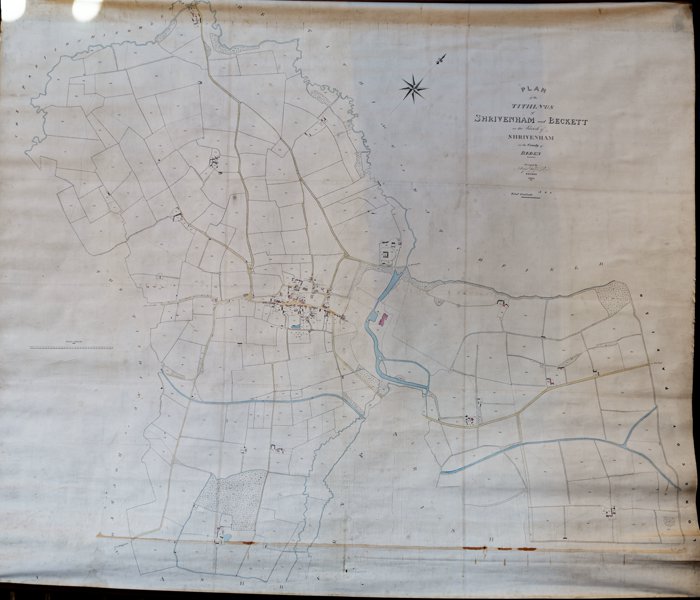
Tithe Map of Shrivenham & Beckett dated 1838
This is a large map drawn on canvas and was likely to have been commissioned by the local authority for the collection of taxes. It has been carefully photographed and stored in our Digital Vault in three images; the whole map, the central portion that covers the village of Shrivenham and a close up of Fryars Farm & Mill. These are available to be downloaded upon request.
- Year:1838
- Place:Shrivenham
- Ref:Attic
- Item Ref:N1172
- Find it:Attic
Do you know?
We are always on the look-out for more information about Shrivenham and district. If you have old photos, know of historical facts, old documents (especially deeds) please contact us...
If you would like to view any item please email us to make an appointment, details on the Home page.