
Explore the catalogue
Catalogue
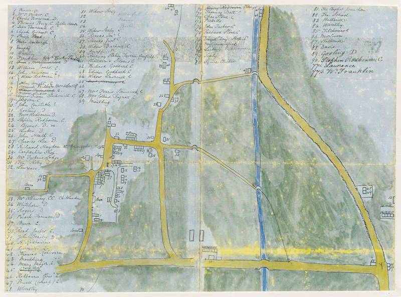
Map of Bourton circa 1865
It's not known who drew this map but it is remarkably accurate. It shows where all the properties are located and who occupied them at the time of the survey. By a careful study of occupiers names when compared to known historical facts, we are able to conclude with a high degree of certainty that it was compiled and drawn in 1865. It is a useful tool for researchers and access to a high resolution scan is available in the SHS Digital Vault upon request.
- Year:1865
- Place:Bourton
- Ref:Chest1
- Item Ref:N1217
- Find it:Chest1
Do you know?
We are always on the look-out for more information about Shrivenham and district. If you have old photos, know of historical facts, old documents (especially deeds) please contact us...
If you would like to view any item please email us to make an appointment, details on the Home page.