
Explore the catalogue
Catalogue
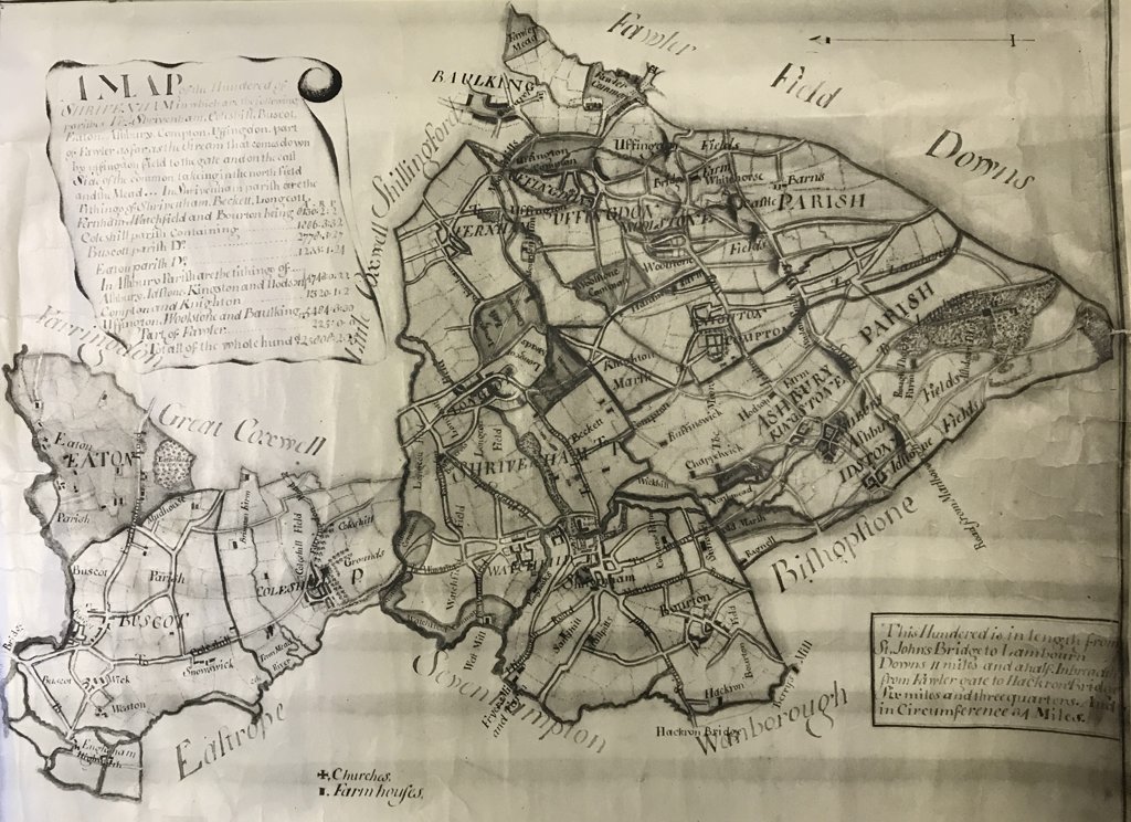
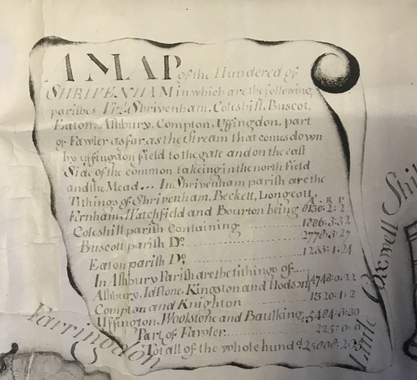
A Map of the Shrivenham Hundred
This is a copy of a map of the Hundred of Shrivenham. The term 'Hundred' was brought in by the Saxons for administrative purposes and remained in use until the beginning of the 19th century. This map describes the extent of the Hundred of Shrivenham as, 'in length from St John's Bridge (Lechlade) to Lambourn Downs - 11.5 miles. In breadth from Fawler Gate to Hackeron Bridge (Acorn Bridge) 6.75 miles. And i circumference 34 miles.'
- Year:1720 circa
- Place:Shrivenham
- Ref:Clip1
- Item Ref:N548
- Find it:Clip1
Do you know?
We are always on the look-out for more information about Shrivenham and district. If you have old photos, know of historical facts, old documents (especially deeds) please contact us...
If you would like to view any item please email us to make an appointment, details on the Home page.