
Explore the catalogue
Catalogue
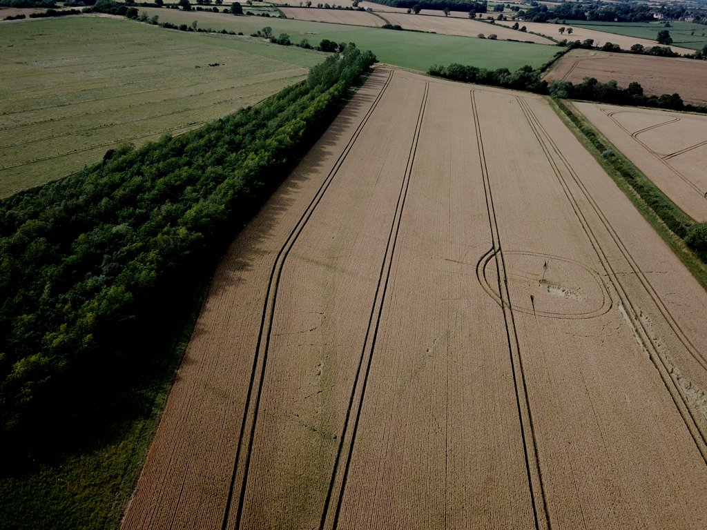
Roman Farm at Bourton
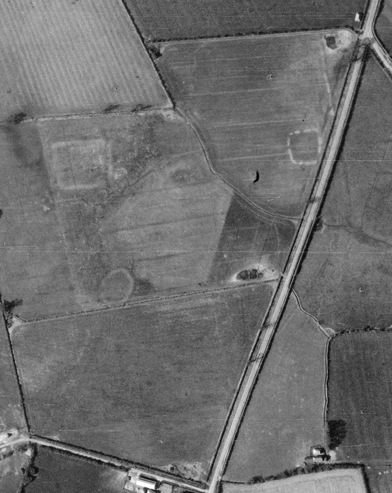
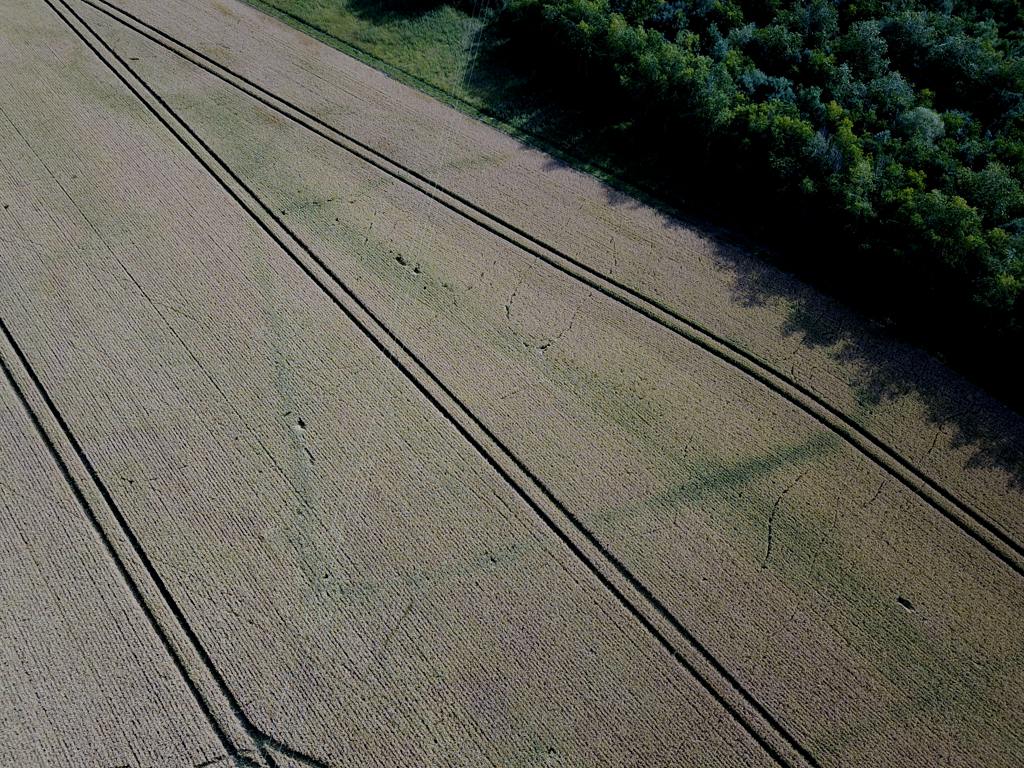
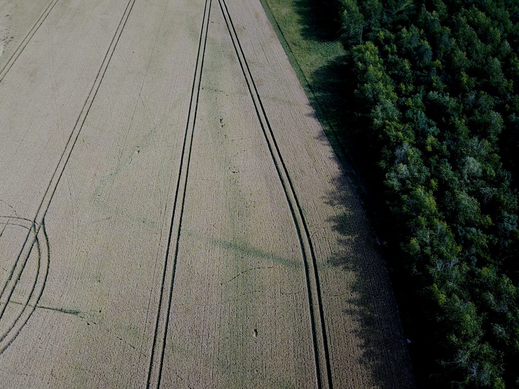
This site was first discovered by studying an RAF reconnaisance photograph taken in April 1946. It showed quite clearly an enclosure that most probably contained an early farmstead. Shrivenham Heritage Society member Neil Maw visited the site after ploughing one year and it was immediately evident to him, by the large amounts of broken pottery that its main use was from the 2nd and 3rd century AD. He made various drone flights over the site in the following years and after one exceptional year in particular managed to capture the area shown by the RAF photograph of 1946.
It is very likely that this was a small farmstead and that one or two roundhouses were located here surrounded by a ditched enclosure. The area surrounding the enclosure would have been used for agriculture.
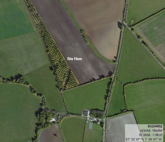
One of the photographs shown in this listing also displays the exact latitude and longitude for future historians and archaeologists.
- Year:2019
- Place:Bourton
- Ref:Online only
- Item Ref:N1105
- Find it:Online only
Do you know?
We are always on the look-out for more information about Shrivenham and district. If you have old photos, know of historical facts, old documents (especially deeds) please contact us...
If you would like to view any item please email us to make an appointment, details on the Home page.