
Explore the catalogue
Catalogue
The Origins of Shrivenham
With the goverment's enthusiasm to build more in order to alleviate a national shortage of housing, the builders have been buying up land around Shrivenham. One of the conditions of the Planning Application process, is that an archaeological evaluation is carried out beforehand. Usually this requires a GeoPhysics Survey and if there are clear indications of human activity then exploratory excavations follow. The results of the surveys and excavations are generally made public and it's from these that we can gain valuable information concerning local history.
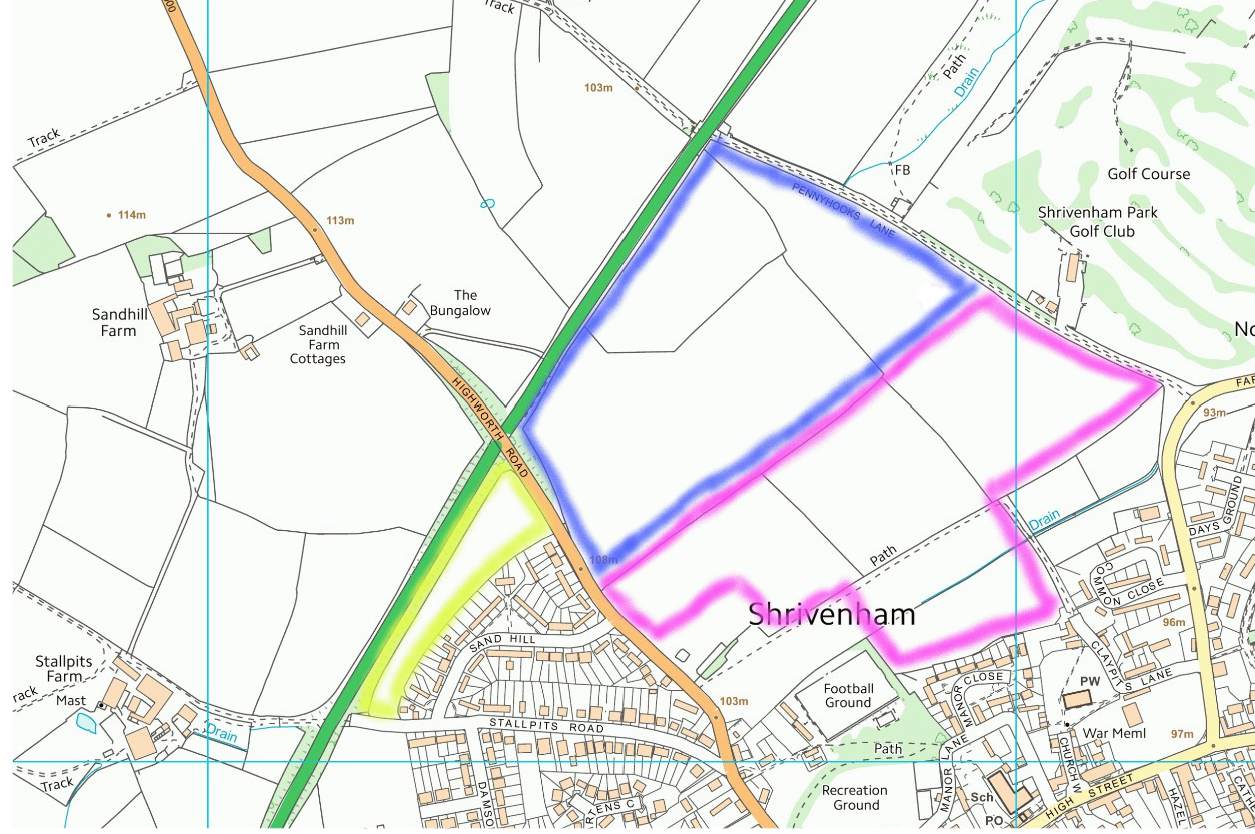
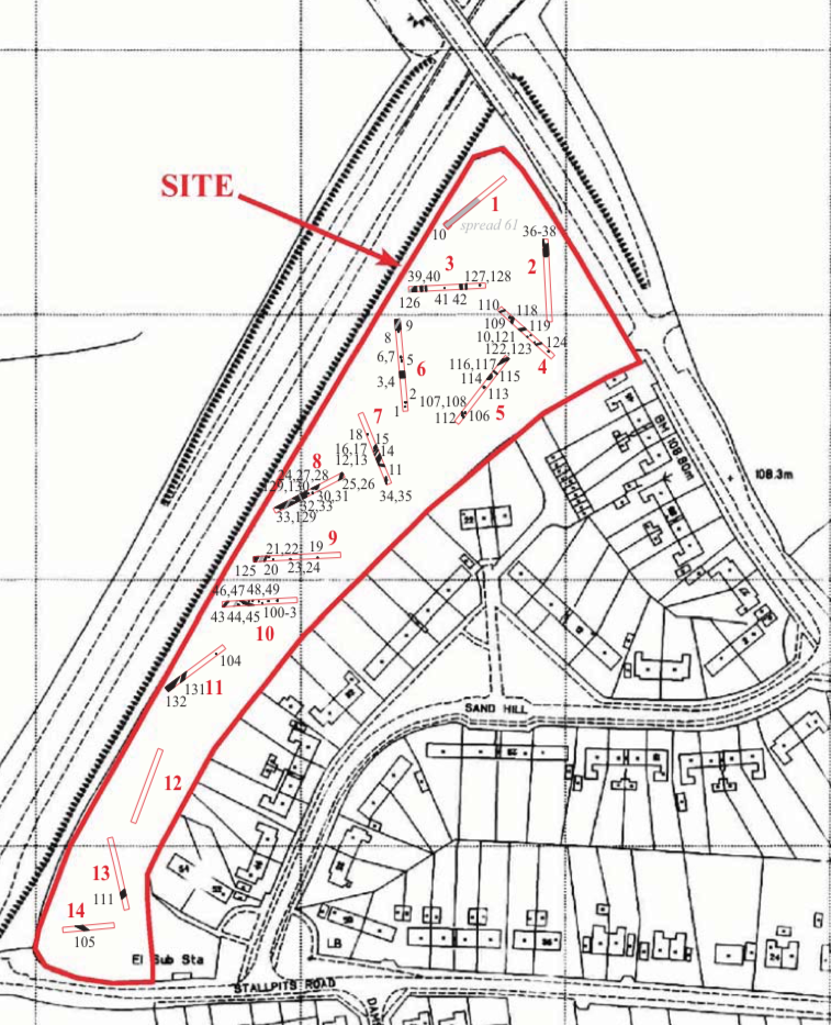
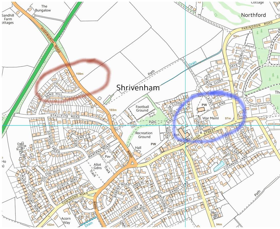
On the Highworth Road leading out of the village, three sections of land have been surveyed and excavated. Building has already commenced on one, but the other two have been sold on with 'Outline Planning Permission,' and await a buyer.
This Listing explains what was discovered on those three pieces of land.
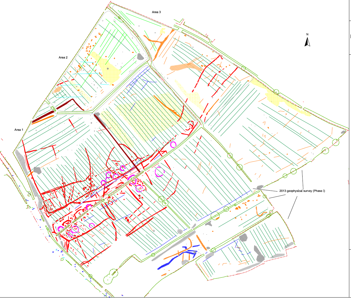
The parcels of land bordered in purple and blue were surveyed together by Archaeological Surveys Ltd, and the photograph of the survey reflects that.
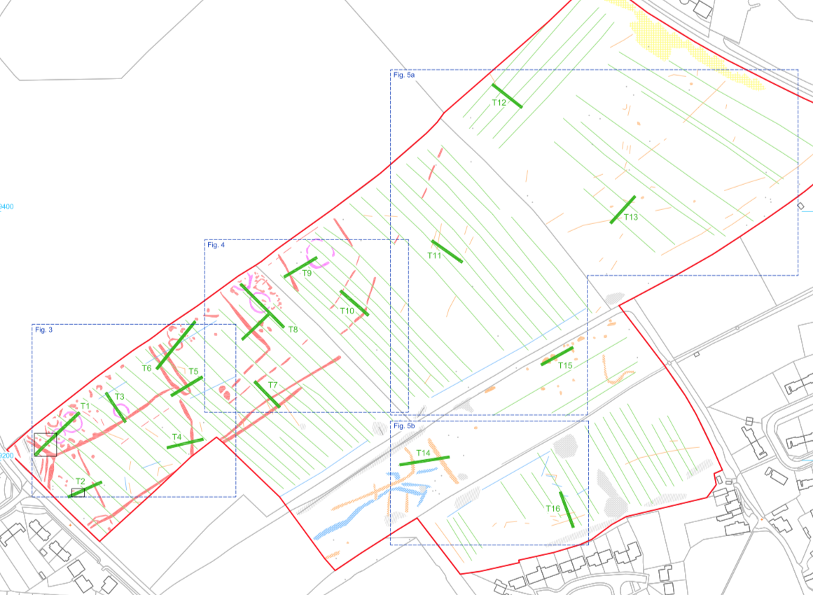
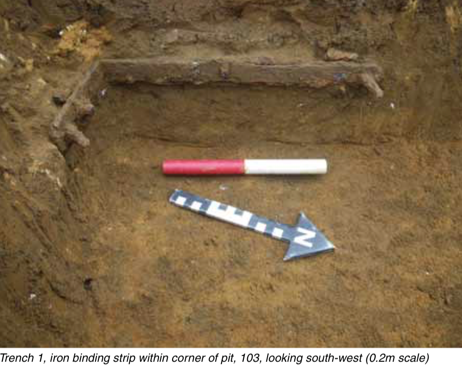
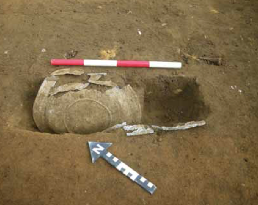
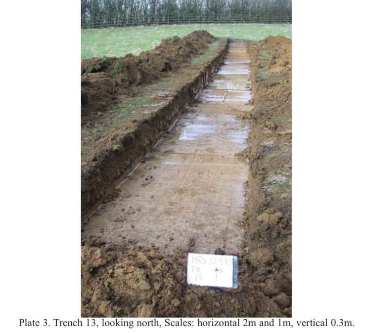
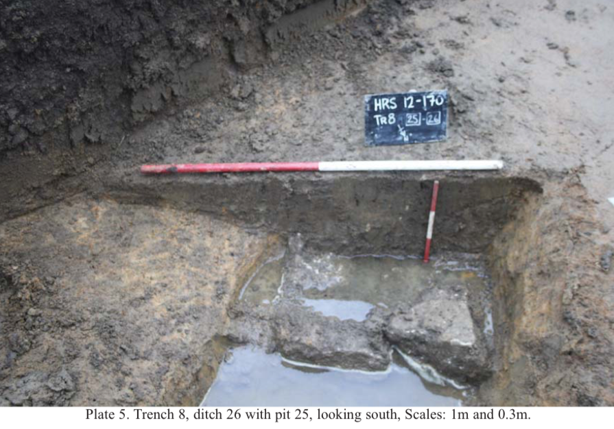
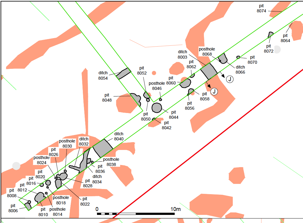
The parcel in purple is the nearest to the village, and was the first to be excavated in October 2013 by Cotswold Archaeology for Welbeck Strategic Land. The land measures 15.87ha and 16 trenches were opened and examined. Photo number 3 shows the location of the trenches. The majority of the finds were predominently pottery and animal bones. Most of the pottery dated to the middle Iron Age (circa 600BC). But there were pottery fragments from earlier periods and later up to the Mediaeval period. The most interesting find came from Trench 1, where remains of a wooden box was discovered. The wood had rotted away but its shape was determined by the remaining iron binding strips. Inside the box were the fragmented remains of two pewter/lead alloy plates. Found with the box were 23 sherds of 4th century Roman pottery which by association, strongly suggested that the box and plates also dated to that period.
The presence of Roman material was not prolific, but there was enough of it to suggest that a Roman Settlement was very likely to be in the near vicinity. In trench 8 a roof tile or 'Tegula,' was discovered which lends more weight to this supposition. Many postholes were discovered with associated pits which suggest that there were numerous roundhouses. It is also probable that there was Iron Age dwellings all along the elevated ground at this location.
The land bordered in yellow shown in the first photo of this listing is 1.5ha in size and was examined in 2014. This was commissioned by Persimmon Homes & Hannick Homes, for a Planning Application submitted to the Vale of White Horse District Council. The evaluation was carried out by Thames Valley Archaeological Services Ltd from 13th to 20th January, 2014. It was a wet month and the water caused considerable difficulty for the excavators.
The results of the 14 trenches revealed a high density of ditches, gullies, pits and postholes, mainly dating to the early to mid Iron Age (approx 600BC). But there was also Roman pottery present as well, lending weight to a later Roman settlement somewhere nearby. There were also animal bones, mainly cattle but also sheep, deer and pigs. An elongated piece of thin copper was also discovered, folded over several times as though being prepared to be traded or recycled.
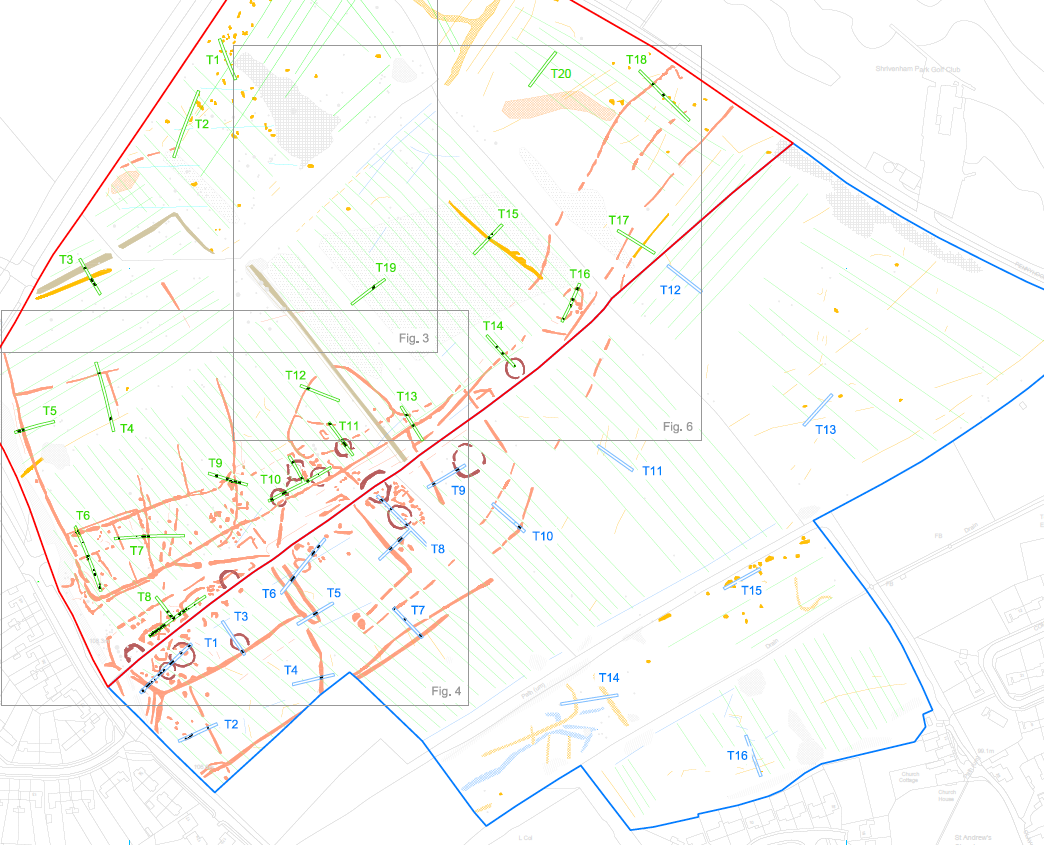
The land bordered in blue in the first photo of this listing is 10.2ha in size and was examined in 2015. It was commissioned by Welbeck Strategic Land, for a Planning Application submitted to the VOWH District Council. The evaluation was carried out by Cotswold Archaeology in the period 23rd Feb to 6th March, 2015.
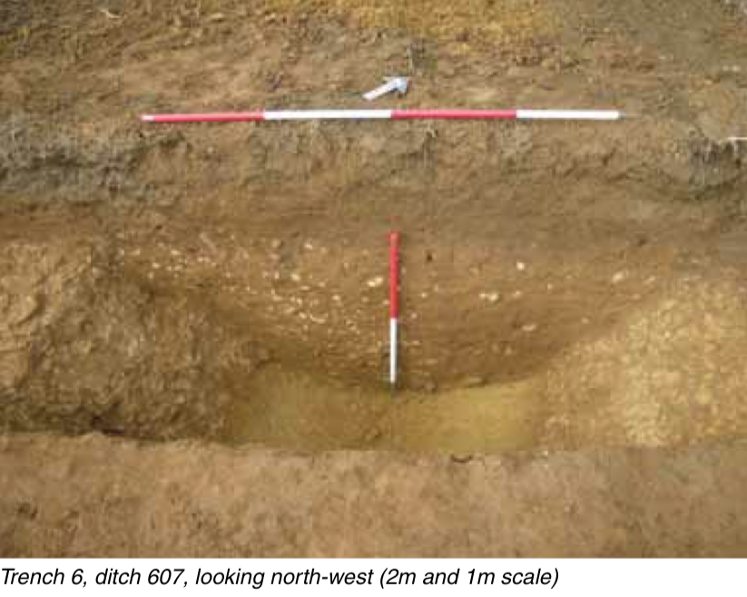
Twenty trenches were opened in order to examine points of interest that were highlighted by the GeoPhysical Survey. The artefact assemblage indicated that activity began in the middle Bronze Age and continued throughout the Iron Age. This, overall, falls in line with the other two evaluations.
So, from these evaluations perhaps we can suggest the following. As the Neolithic period evolved into the Bronze Age, the raised area on the north side of Shrivenham was inhabited by the indigenous people. By the Roman period the settlement that would be known as Sandhill today, was falling out of use, but the locals of the Roman period were still using the surrounding fields for agriculture. Could it be that by the beginning of the Anglo Saxon period, the nucleus of the settlement had moved? Is it possible that an early Saxon Church, built of wood, stood on the ground where St Andrew's stands now, and the village we know today as Shrivenham evolved around it?
Collated by Neil B. Maw
Please see N1003 in this catalogue for more information an
N1020 for a photographic tour of the excavations in 2018
- Year:2013 - 2016
- Place:Shrivenham
- Ref:Online only
- Item Ref:N1450
- Find it:Online only
Do you know?
We are always on the look-out for more information about Shrivenham and district. If you have old photos, know of historical facts, old documents (especially deeds) please contact us...
If you would like to view any item please email us to make an appointment, details on the Home page.