
Explore the catalogue
Catalogue
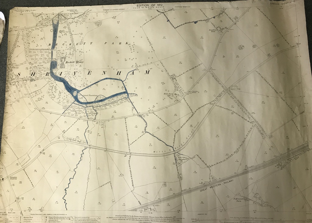
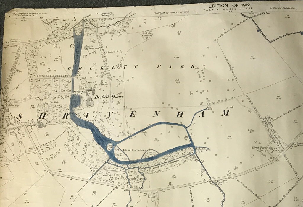
Ordnance Survey Map of Beckett & close area 1912
This is a most iinteresting map and shows perfectly the layout of the Beckett Park in 1912, just before the estate was broken up and sold. It also includes the immediate area to the east of Beckett.
- Year:1912
- Place:Beckett
- Ref:Clip3
- Item Ref:N1541
- Find it:Clip3
Do you know?
We are always on the look-out for more information about Shrivenham and district. If you have old photos, know of historical facts, old documents (especially deeds) please contact us...
If you would like to view any item please email us to make an appointment, details on the Home page.