
Explore the catalogue
Catalogue
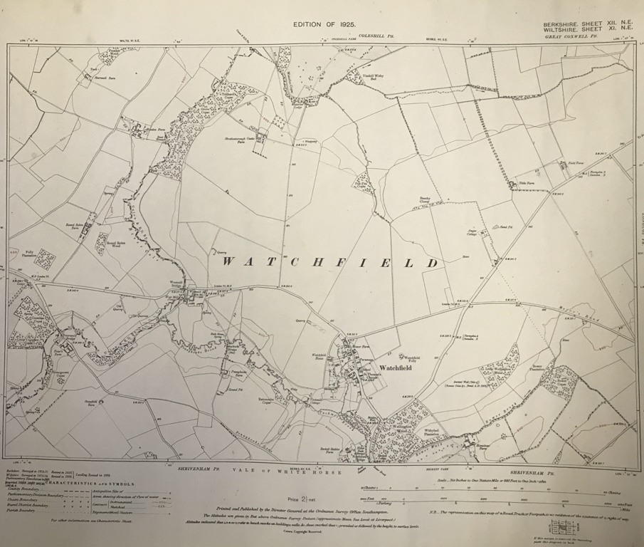
Ordnance Survey Map of Watchfield 1925
This map covers the village and parish of Watchfield and also takes in Fresden and Friars Farm. It is in good condition and represents an accurate depiction of the layout of the area in 1925. it measures 50cm X 40cm and is Berks Sheet XII (12) & Wilts XI (11) both NE
This map and other was donated by Ronnie Holcombe of Shrivenham
- Year:1925
- Place:Watchfield
- Ref:Clip2
- Item Ref:N1152
- Find it:Clip2
Do you know?
We are always on the look-out for more information about Shrivenham and district. If you have old photos, know of historical facts, old documents (especially deeds) please contact us...
If you would like to view any item please email us to make an appointment, details on the Home page.