
Explore the catalogue
Catalogue
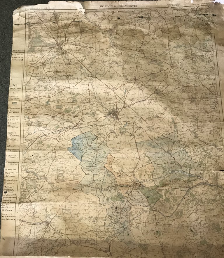
Map of Swindon & Cirencester used by Marlborough Gas Co in 1937
A map of Swindon & Cirencester used by the Marlborough Gas Co, labelled, 'extensions of limits of supply 1937.' It gives a key on the margain at the side, explaining the numbers on the map to the numerous villages. Tatty and well used but still legible. Measures approx 100cm X 70cm.
- Year:1937
- Place:Swindon District
- Ref:Clip3
- Item Ref:N1540
- Find it:Clip3
Do you know?
We are always on the look-out for more information about Shrivenham and district. If you have old photos, know of historical facts, old documents (especially deeds) please contact us...
If you would like to view any item please email us to make an appointment, details on the Home page.