
Explore the catalogue
Catalogue
Who lived where in Shrivenham in 1866
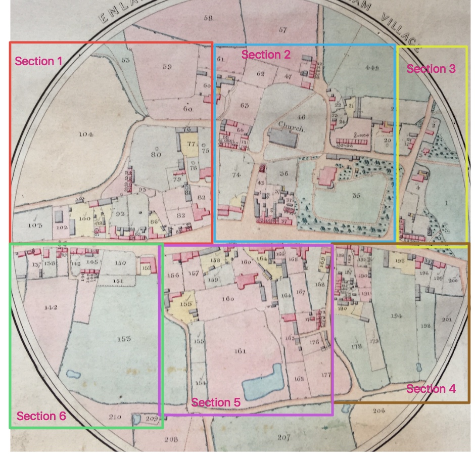
For the purposes of this listing, this estate map has been divided in to 6 sections. First consult the large map attached to this listing and choose the area of the village you would like to study. Then go to the listings below. This map can also be compared with the Tithe map in Listing number N239 from 1844.
To look at Section 1 - please go HERE
To look at Section 2 - please go HERE
To look at Section 3 - please go HERE
To look at Section 4 - please go HERE
To look at Section 5 - please go HERE
To look at Section 6 - please go HERE
Info collated & photos by Neil B. Maw
- Year:1866
- Place:Shrivenham
- Ref:Online only
- Item Ref:N215
- Find it:Online only
Do you know?
We are always on the look-out for more information about Shrivenham and district. If you have old photos, know of historical facts, old documents (especially deeds) please contact us...
If you would like to view any item please email us to make an appointment, details on the Home page.