
Explore the catalogue
Catalogue
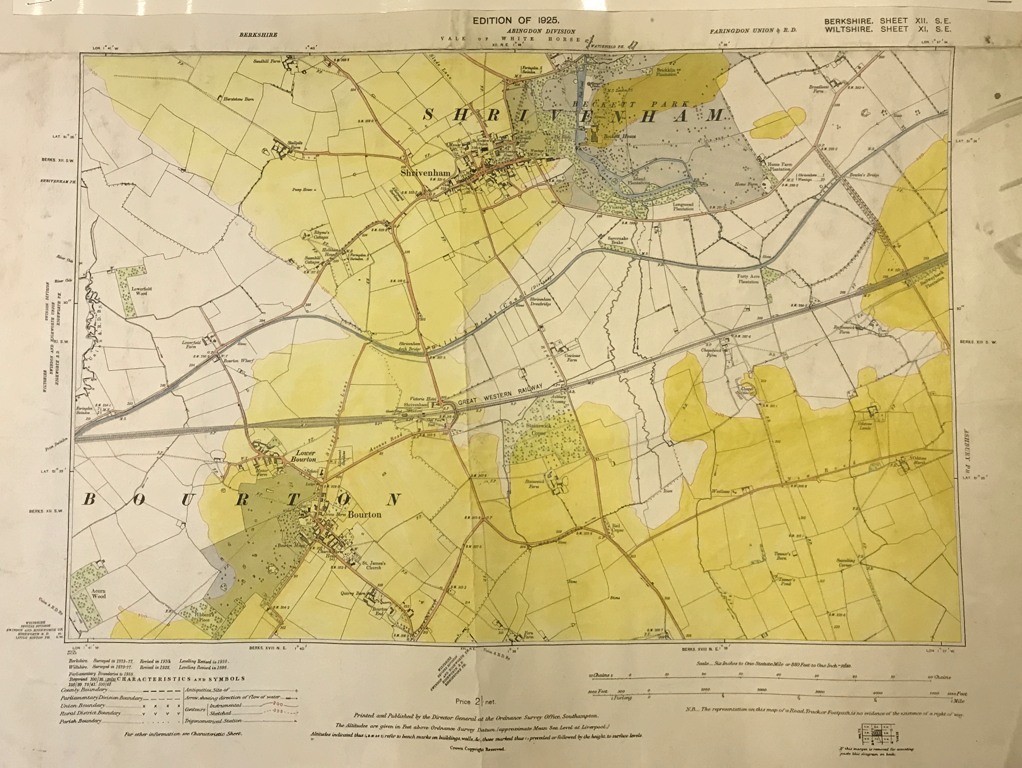
Ordnance Survey Map of Bourton & Shrivenham 1925
This map measures 45cm X 30cm and is printed on thick map paper and black & white, N848 (1). It covers the sheets Berks X11 (12) and Wilts X1 (11) both SE and dated 1925. It covers Bourton and Shrivenham. There is also another map exactly the same, but in colour N848 (2).
- Year:1925
- Place:Bourton & Shrivenham
- Ref:Clip2
- Item Ref:N848
- Find it:Clip2
Do you know?
We are always on the look-out for more information about Shrivenham and district. If you have old photos, know of historical facts, old documents (especially deeds) please contact us...
If you would like to view any item please email us to make an appointment, details on the Home page.